
NSS PO attends training programme on Mapathon
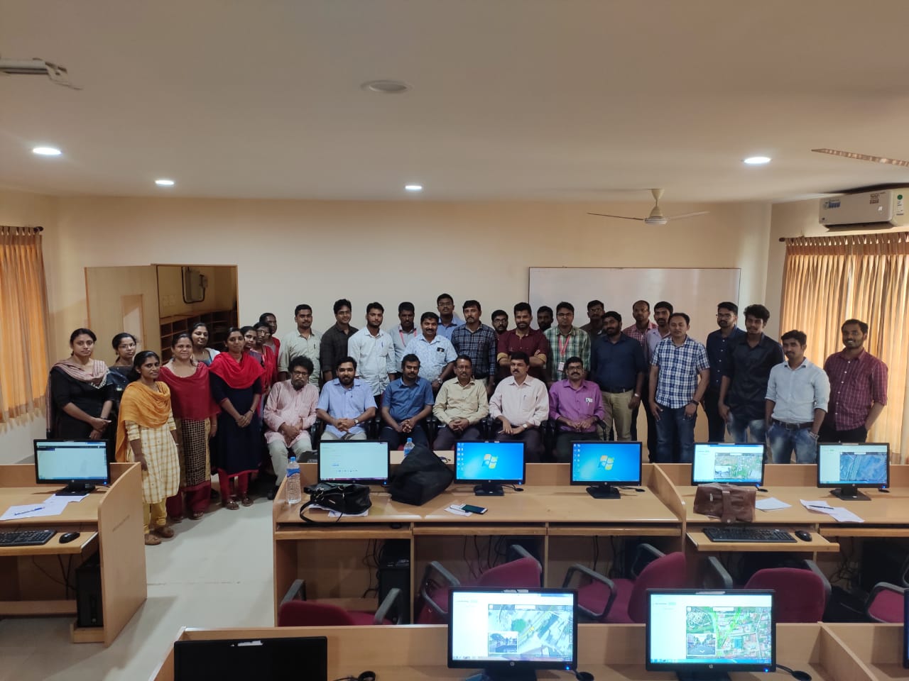
 Mr Cinto P A (NSS Programme Officer and AP, ME Dept) attended a training programme on Mapathon which is a geotagging programme planned to be organised by Kerala State NSS Technical Cell with the support of Kerala State IT mission. Mapathon is a project that aims to share the knowledge of OpenStreetMap among people and create a free editable map of Kerala. Such a map would be very useful to the society in view of flood related activities. The training programme was conducted at Albertian Institute of Technology, Ernakulam on 20 September 2019. Hands on training for signing in and adding details (buildings, streets etc.) to OpenStreetMap was given during the training. Programme officers from various engineering colleges across Kerala attended the programme.
What is Mapathon?A mapathon is a coordinated mapping event. The public is invited to make online map improvements in their local area to improve coverage and to help disaster risk assessment and energy management. Mapathons use an online site for storing map data, for example, Google Maps and OpenStreetMap. A mapathon is organized by a respective organization or a non-profit organisation or local government. Mapathons are often held inside (armchair mapping) in a room with strong Wi-Fi for simultaneous access, assisted by satellite imagery. Mapathons can also be an outside activity with online simultaneous map editing assisted by global positioning system trackers on mobile devices. (Wikipedia) What is OpenStreetMap?OpenStreetMap (OSM) is a collaborative project to create a free editable map of the world. The geodata underlying the map is considered the primary output of the project. The creation and growth of OSM has been motivated by restrictions on use or availability of map data across much of the world, and the advent of inexpensive portable satellite navigation devices. OSM is considered a prominent example of volunteered geographic information. Created by Steve Coast in the UK in 2004, it was inspired by the success of Wikipedia and the predominance of proprietary map data in the UK and elsewhere. Since then, it has grown to over two million registered users, who can collect data using manual survey, GPS devices, aerial photography, and other free sources. This crowdsourced data is then made available under the Open Database License. The site is supported by the OpenStreetMap Foundation, a non-profit organisation registered in England and Wales. (Wikipedia) |